
Your whole trail network on one map
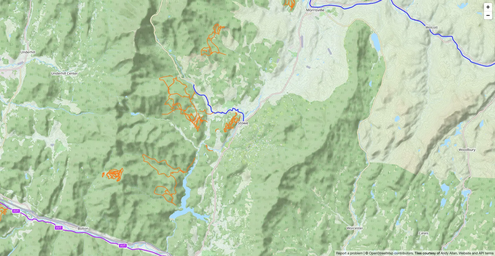
Stop rebuilding your network from old plans, screenshots and what your volunteers remember. Sentinel brings every trail, every task and every structure onto a single interactive map — on the web at the office, on the phone in the field, with or without signal.
What is network mapping in Sentinel?
Mapping is the layout of your trails: their geometry, their name, their difficulty and the activities they allow, imported from your GPX files. It is the backbone of everything else — tasks, structures and conditions all attach to a trail.
- Replaces
- Old paper maps, screenshots of maps, and GPX files scattered across several computers.
- Where it happens
- Network built on the web, consulted on the phone in the field, with or without cell coverage.
One map, the whole network, always current
You open the dashboard and you see your entire network: trails by activity and difficulty, maintenance tasks still open, structures waiting on an inspection. No more cross-referencing three files to figure out where a sector stands. When a crew creates a task in the field, it shows up on the office map.
- Trails, tasks and structures on the same base map
- Filter by activity, difficulty and status
- Updated as soon as a crew records something on site
Every problem pinned exactly where it is
A crew member comes across a tree down across the trail. They pull out their phone, take a photo, pick the problem type: the task is created with its GPS position, on the right trail. Nobody has to describe "about 300 metres past the second junction". The next crew opens the map and walks straight to it.
- GPS position recorded automatically on creation
- Photos and problem type attached to the point
- The task attaches itself to the right trail
The map keeps working where cell coverage stops
Most trails sit outside coverage. Sentinel's map stays usable with no signal: you still see your trails, your tasks and your structures, and you keep creating new ones. Everything syncs when you are back in coverage, without anyone having to think about it.
- Map, tasks and structures viewable with no signal
- Create tasks and reports offline
- Automatic sync when the signal comes back
What a network map has to do
The whole network
Your trails, your sectors, your structures and your tasks on one base map, instead of scattered across separate files.
Web, iOS and Android
The same map at the office and in the field. What the phone records, the dashboard shows.
Usable off-grid
The map does not stop at the edge of cell coverage. You view and you create; the sync catches up.
Frequently asked questions
Can I map an entire trail network in one tool?
Yes. Sentinel shows your whole network on one interactive map, with every task and structure geolocated. The map works on web, iOS and Android, and stays usable offline in the field.
What should a trail organization look for in trail mapping software?
A map of the full network, geolocation of tasks and structures, an offline mode for the field, and exportable reports for partners and grants. Sentinel brings these together in a single web and mobile platform.
Can I import existing trail data?
Yes. Sentinel supports GPX file imports, so you can bring in your existing trail network data. You can also export your task data for use in GIS applications or reports.
Does Trail Sentinel handle ATV and snowmobile trails?
Yes. ATV (quad) and snowmobile are two of Trail Sentinel's twelve activities, alongside mountain bike, hiking and cross-country skiing. A motorized club tracks its ruts, culverts, drainage and signage the same way a bike club tracks its trails — on the same map, with the same field app that works without coverage. Off-highway vehicle (OHV) networks are managed the same way.
Can I manage a summer network and a winter network in the same account?
Yes, and that is the normal setup. Each activity is a watertight partition: its trails, tasks, structures, types and condition board belong to it alone. A club that maintains bike trails in summer and snowmobile trails in winter switches on both activities and moves between them — the summer map never shows the winter routes, and the analytics never mix the two seasons.
How it's done, step by step
The documentation articles covering this feature, written for the person who uses it.
- 01Import your GPX tracks, sort them by activity and difficulty. Almost everything else in Sentinel hangs off them.W
- 02Biking, hiking, cross-country skiing, ATV, snowmobile — each activity has its own trails, tasks and types. Here's how to turn them on and switch between them.WM
- 03Difficulty levels give trails their symbol and their colour on every map. Here's how to set them, reorder them, and what deleting one breaks.WM
See your network as it actually is
One interactive map that holds your trails, your tasks and your structures — at the office and in the field, with or without signal.